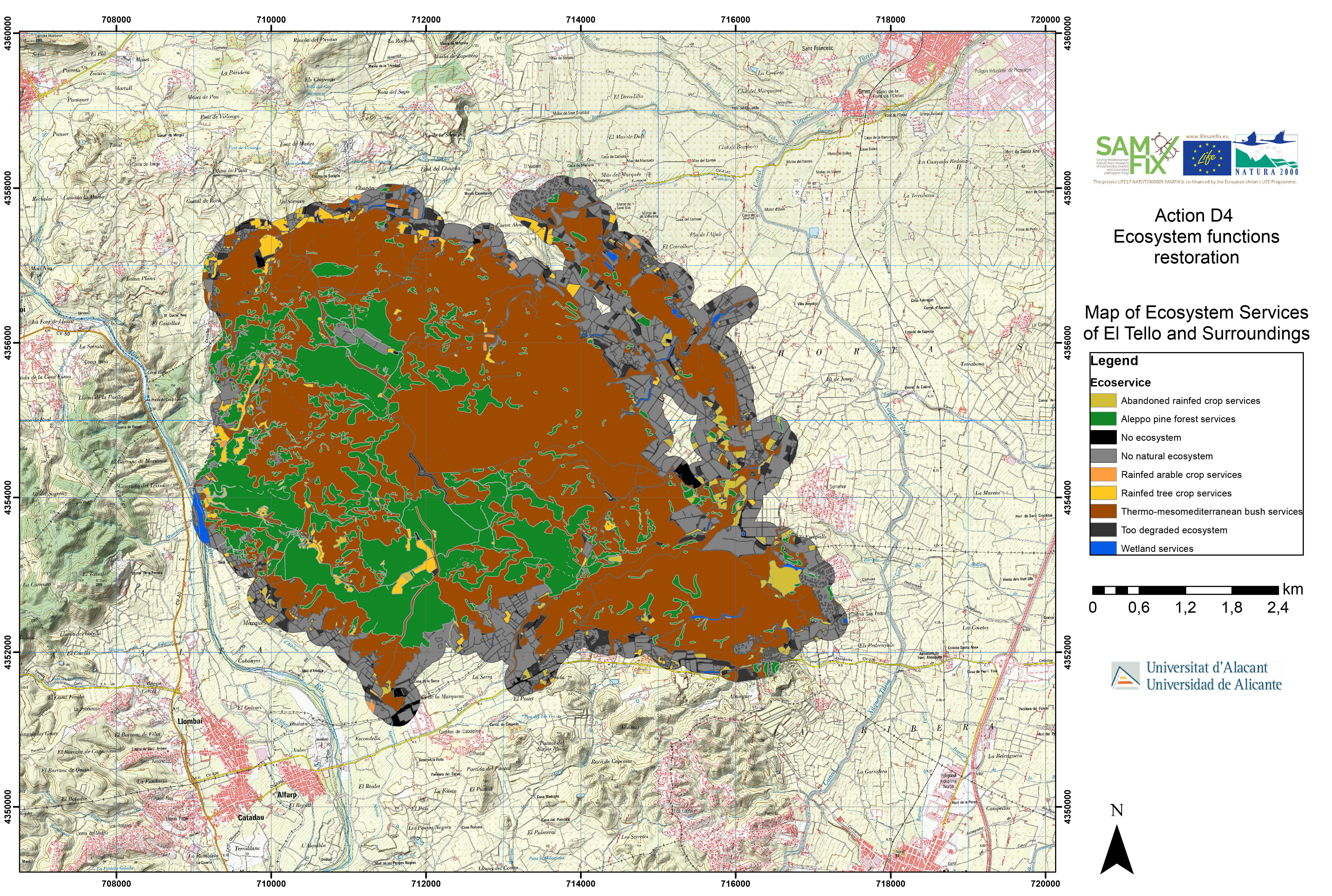

A map of Ecosystem services for El Tello and Surrounding has been drawn by the UA team. This implied the digital cartography on 4151 ha of natural and semi-natural ecosystem and land uses (agriculture, residential, routes,…), using the aerial photos RGBI of Comunitat Valenciana (25 cm pixel). Flights hereto were performed between 13/06/2018 to 30/07/2018.
This cartography of ecosystems and land uses has been translated into Ecosystem Services, posed to assessing services that can be given by six kinds of mapped units, that is: abandoned rainfed tree crop, Aleppo pine forest, rainfed arable crop, rainfed tree crop, thermo-mesomediterranean scrubs and wetlands. The total amount of surface that offers Ecosystem Services is 3189 ha, a 76,82 % of studied surface.
This map will be considered the start point to evaluate the possible impacts on these Ecosystem Services by the presence of X. crassiusculus in the studied area.